 1 / 2
Standard checkout available. Verified maker dispatch.
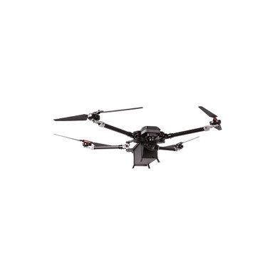
The Peregrine foldable quadcopter is an advanced lightweight industrial drone engineered for precise surveillance, reconnaissance and mapping in demanding field and commercial environments.
The listing says it has autonomous flight capabilities and combines real-time video transmission, multi-band RTK GNSS positioning and an intelligent flight computer to keep the mission stable even in complex terrain.
It is controlled with the axl OneView smart controller with an integrated display and runs the axl DOS custom drone operating system.
Up to 50 minutes of flight: long endurance for surveys.
Up to 15km range: real-time HD video and control.
Multi-band RTK GNSS: centimetre-accurate positioning.
Dual-light stabilised gimbal camera: for surveillance and inspection.
axl OneView smart controller: integrated display.
Foldable, lightweight airframe: an industrial quadcopter that is easy to transport.
A professional multirotor is built around a stiff, light frame, an efficient propulsion system and a flight controller that flies the aircraft automatically. For missions such as mapping, inspection or surveillance, the pilot plans a route on a ground station and the aircraft flies it by itself, using GNSS for position. RTK GNSS adds a correction signal that reduces position error from metres to centimetres, which is important for survey work.
Range and endurance depend on the battery, the payload and the weather. Always plan flights with a reserve, check the wind and the battery state before take-off and keep the aircraft within the range of the radio link. Professional aircraft need regular inspection: check the motors, the propellers, the arm joints and the battery health before every mission.
Drone operations are regulated. Before you fly, find out what registration, certification, pilot training and airspace permissions your country requires, and follow them. Keep the manual, the warranty card and the flight logs for each aircraft.
Surveillance and reconnaissance
Mapping and inspection
Utility missions
Field operations in complex terrain
Commercial and industrial drone programmes
The technical specifications list a flight endurance of up to 50 minutes, a transmission range of up to 15km, a multi-band RTK GNSS module with centimetre accuracy, a dual-light stabilised gimbal camera, the axl OneView smart controller with integrated display, the axl DOS operating system and a foldable lightweight industrial quadcopter airframe.
The package includes the axl Peregrine, a radio controller, two 12000mAh batteries, a battery charger, a fibreglass protective case, a user manual, a warranty card and online installation assistance. The page showed 5 in stock.
Endurance: up to 50 minutes
Transmission range: up to 15km (HD video and control)
Positioning: multi-band RTK GNSS, centimetre accuracy
Camera: dual-light stabilised gimbal camera
Controller: axl OneView smart controller with integrated display
Operating system: axl DOS
Airframe: foldable lightweight industrial quadcopter
1 x axl Peregrine
1 x radio controller
2 x 12000mAh battery
1 x battery power charger
1 x fibreglass protective case
1 x user manual
1 x warranty card
1 x online installation assistance
Commercial and industrial operators who need a foldable RTK quadcopter for surveillance and mapping.
Up to 50 minutes.
Up to 15km for HD video and control.
Multi-band RTK GNSS with centimetre accuracy.
A dual-light stabilised gimbal camera.
The axl OneView smart controller with an integrated display.
The drone, controller, two batteries, charger, case, manual and warranty card.
| Brand | Axldrone |
|---|---|
| Camera | Dual-light stabilised gimbal camera |
| Control Range | Up to 15 km |
| Flight Time | Up to 50 minutes |
| Positioning | Multi-band RTK GNSS (centimetre accuracy) |
| Selling unit | PCS |