 1 / 4
Standard checkout available. Verified maker dispatch.
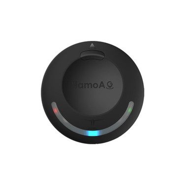
The NamoAG Precision GPS/GNSS Module is a high-performance navigation solution built for modern agriculture drones and precision UAV applications. It delivers reliable and accurate positioning in dynamic field environments.
It tracks multiple satellite constellations at the same time for strong signal availability and consistent navigation. With a positional accuracy of 1.5m to 3m CEP, integrated noise-reduction components and a high-sensitivity compass, it supports precise flight control, stable heading detection and efficient agricultural operations.
Its compact, lightweight design and DroneCAN communication protocol make it easy to integrate into advanced agricultural drone platforms that need robust, real-time navigation data.
Multi-constellation support: simultaneously tracks GPS, GLONASS, Galileo, BeiDou, SBAS and QZSS.
High navigation accuracy: 1.5m to 3m CEP.
Compact and lightweight: 61.82 x 61.82 x 19.81mm and about 30g.
Built-in SAW filters and LNA: improve signal quality.
High-sensitivity compass: +/-8 Gauss magnetic range.
DroneCAN: robust digital communication.
Optimised for agriculture drones: designed for field operations.
Instead of sending simple serial data, a DroneCAN GPS talks to the flight controller over a CAN bus. This is a robust two-wire network that is more resistant to electrical noise than a plain UART, and it lets several devices share the same cable.
In an agricultural spraying drone, accurate position and heading are essential for flying straight, evenly spaced passes. The GNSS receiver supplies position and the compass supplies heading, and both are reported to the flight controller as CAN messages.
Mount the module on a mast away from motors, power wiring and the spray system, so magnetic interference does not disturb the compass. Configure the flight controller to use the DroneCAN device and check that it reports a good satellite count before you spray.
Agricultural spraying drones
Precision UAV surveys
DroneCAN-based flight controller builds
Autonomous field operations
Replacing a GPS on a professional platform
The specification table lists the brand as PDRL, a u-blox NEO-M9N receiver, an M4 STM32F4 processor, a 35 x 35mm antenna, a 5V DC input and DroneCAN as the output protocol.
The listing does not include a package contents section, so confirm cables and mounting hardware with the seller.
Brand: PDRL
Receiver: u-blox NEO-M9N
Processor: M4 STM32F4
Antenna: 35 x 35mm
Input voltage: 5V DC
Output protocol: DroneCAN
Accuracy: 1.5m to 3m CEP
Compass range: +/-8 Gauss
Size: 61.82 x 61.82 x 19.81mm
Weight: about 30g
1 x NamoAG precision GPS/GNSS module
Agricultural drone operators and integrators who want a DroneCAN GNSS module with a built-in compass.
DroneCAN.
A u-blox NEO-M9N.
1.5m to 3m CEP.
GPS, GLONASS, Galileo, BeiDou, SBAS and QZSS.
About 30g.
5V DC.
| Brand | NamoAG |
|---|---|
| Dimensions | 61.82 x 61.82 x 19.81 mm |
| GNSS Chipset | u-blox NEO-M9N |
| GNSS Constellations | GPS, GLONASS, Galileo, BeiDou, SBAS, QZSS |
| Input Voltage | 5V DC |
| Protocol | DroneCAN |
| Weight | 30.000000 g |
| Selling unit | PCS |